About
Resources
Research
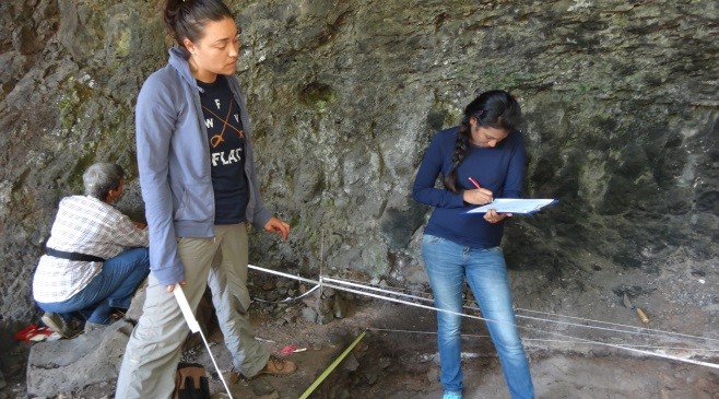
In line with one of its main objectives, Le Morne Heritage Trust Fund (LMHTF) is pursuing multidisciplinary research (archaeological, anthropological and historical) on Le Morne Cultural Landscape (LMCL) not only to have in-depth knowledge on the rich layers of history of the place, but to enhance the Authenticity and Integrity of the LMCL, hence protecting its Outstanding Universal Value of Le Morne which lies at the core of its protection and management. Research on LMCL is done in collaboration with archaeologist, anthropologist and as well as the community of Le Morne Village participation through face to face interview.
The objects of the Fund as per LMHTF ACT 2004:
- To preserve and promote the historical, cultural, environmental and ecological aspects of Le Morne
- to set up a museum and create public awareness in the history of Le Morne;
- To encourage research and support projects and publications related to slavery and marronage
- To collect, publish and disseminate information pertaining to the history of slavery and marronage
Research work carried out by Le Morne Heritage Trust Fund
In order to have a comprehensive management system in place for Le Morne, there is need to understand the concept of a Cultural Landscape. The Cultural Landscape concept was integrated into the Operational Guidelines for the Implementation of the World Heritage Convention in 1992 with the adoption of the Cultural Landscape categories by the 16th session of the World Heritage Committee, recognising critical linkages between nature and culture, people and place and between the intangible and the tangible.
It is clearly acknowledged that cultural landscapes are more than just the physical vessels in which the heritage occurs. These are places where one can learn about the relationship between people, nature and ecosystems through time, and how these relationships shaped culture and identity, whereby enriching the understanding and appreciation of the heritage embodied therein. In the case of Le Morne, the cultural landscape is particularly rich, forming the bridge between culture, people and place, and, where heritage that resonates globally was forged through time. It is a good example of how history, memory and contemporary practices shape identity.
Archaeological & Anthropological Research
Since 2003, research was first undertaken in the caves on Le Morne mountain summit and the research resulted in a report. Other research such as archaeological, historical and anthropological research was undertaken in Le Morne Village and around the landscape. In order to study the symbolism of Le Morne in the collective memory and in the definition of the identity of the Local Population, it is essential to have a look at the oral data traditions and narratives.
The main goal of undertaking research at Le Morne Cultural Landscape and its surroundings shall be to valorize and promote this landscape. The Le Morne Village has many residents and a large proportion of its inhabitants are migrants from the historic villages of Trou Chenille, L’Embrasure and Macaque (Makak) that were at the foot of Le Morne Brabant Mountain. According to villagers, these settlements were established during the period of slavery and in the post-emancipation. The significance of the historic villagers is heightened by its location within the buffer zone of Le Morne Cultural Landscape, inscribed on the World Heritage List in 2008 for its connection to maroon slaves and the history of land dispossession.
Archaeological Findings: Maroon on Le Morne Brabant Mountain
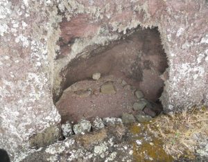
In 2002, a rock shelter on the slope of the mountain was accidentally discovered by an exploration team of the Forestry Department. Subsequently a request was made to the University of Mauritius to conduct further investigations in collaboration with the National Heritage Fund.
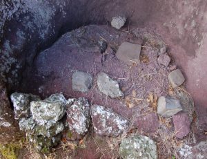
The team of the Maroon Slave Archaeological Investigation Project (2002-2003) consisting of an archaeologist and historians partially discovered three more shelters which revealed:
- Manuports.
- Ashy deposit testifying the use of fire.
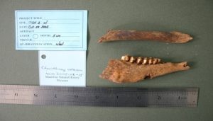
- Bones of animals consumed as food by the occupants of the shelter.
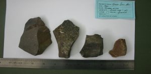
- Several basalt rocks identified as manuports which were arranged to be used as seats.
- An arrangement of stones and several flat semi-polished basalt blocks that are clearly manuports
For the preparation of the Nomination Dossier of Le Morne, further research was carried out on Le Morne and in the Black River Gorges to shed further light on their historical and archaeological relevance: it included new archaeological investigations to enable reinterpretation of the existing archaeological knowledge of the area. Further investigations included soil geochemical analysis on Le Morne summit to verify traces of human occupation and further exploration of the Black River Gorges too. Collection of soil samples and soil cores in selected places from major parts of Le Morne summit and summit slopes resulted in defining several zones with higher phosphorus level from neighboring areas. The organic carbon discovered in the soil indicates human interference on Le Morne.
Furthermore, radio carbon dating of the bones of animals discovered in the cave revealed the presence of a female sheep aged between 9 and 12 months, dating back to 1736 AD and 1807 AD. According to the team, it can be concluded that the sheep was taken into one of the caves to be eaten and in that same cave human occupations were evident.
These archaeological accounts support the position that there were maroons on the top of the mountain and they were able to ensure their survival. This research was important to support the Nomination Dossier for Inscription of Le Morne Cultural Landscape as a World Heritage Site.
Trou Chenille - Former Le Morne village
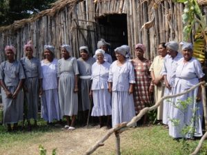
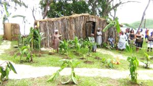
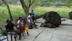
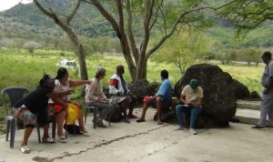
Several elderly people in the actual Le Morne Village who were interviewed have mentioned that they were born and raised in the village known Trou Chenille. It was a small village located at the foot of Le Morne Brabant. Latest historical research dates it to end of the 19th century. But further archaeological and archival research may date it further back.
According to informants, the origin of the name Trou Chenille is believed to be from the worms collected by the fishermen (sini san pie) as bait or from the numerous sea slugs (Bambaras) found in Trou Chenille).
Trou Chenille is the cradle of settlement of the South West region of Mauritius. It is from Trou Chenille that people migrated to Baie Du Cap, Cotteau Raffin, La Gaulette, Case Noyale, Chamarel, Tamarin and other regions of Mauritius. Villages emerged with families from Trou Chenille.
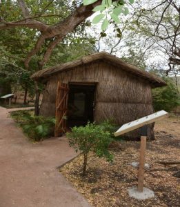
According to informants, this village was the site where the descendants of slaves continued to live after the abolition of slavery was abolished in 1835. The settlement area was composed of about 50 huts. When the old inhabitants of Trou Chenille described their village, they talk about a shop and an old chapel. Water was procured from natural sources and from Ilot Fourneau.
When the straw houses of Trou Chenille were destroyed by the cyclone of 1945, the owner of the lands of Le Morne, displaced the population of the village to L’Embrazure and the other houses around the mountain, so as to recover his lands. Several informants have mentioned that the shop and the chapel were two features that were very important in the lives of the local inhabitants. According to some of the inhabitants, as part of the strategy to re-locate the Trou Chenilles village and its inhabitants the shop and the chapel were the two structures that the landowner had moved first to L’Embrasure.
Thereafter, many residents of Trou Chenilles went to settle in the areas next to where the chapel and shop had been re-located. From L’Embrazure, they were again displaced from there after the cyclone of 1960 to settle in the present village of Le Morne.
Trou Chenille is now considered as one of the attributes that sustain the Outstanding Universal Value of Le Morne Cultural Landscape UNESCO World Heritage Site. Having multiple values, it bears the memory of the descendants of slaves which is still living and conveys the Authenticity of the inscribed World Heritage Property.
Archaeological Survey at Macaque / Makak (Le Morne)
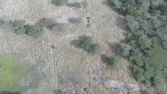
Makak is the name of a 19th and 20th Century settlement along the northern coast of Le Morne Brabant. It is primarily known through oral histories, spoken of by a handful of elders, who locate Makak along the gentle sloping plain between the sea and the northern summit of the mountain Le Morne Brabant
It joins L’Embrasure and Trou Chenille as one of the three main historic settlements immediately around Le Morne Brabant.
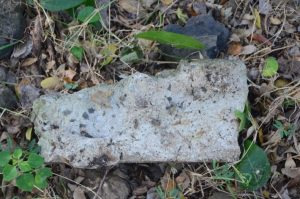
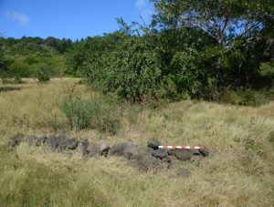
The site was first identified through Oral History research and followed by a preliminary archaeological survey in 2007, where numerous artifacts and other features-evidence of a settlement were found. Further research in 2013 concluded that the settlement is most likely associated with the Labonté and Béguinot families who were originally Malagasy families who came to Mauritius in the early 1800s. They settled in the region and owned fishing establishments, as well as slaves.
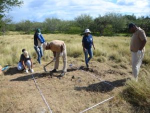
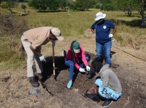
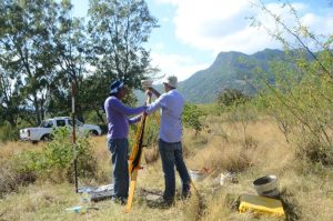
In 2017, archaeological research was undertaken in the area, involving excavation of test trenches and further documentation and mapping of the site. The Ministry of Housing and Lands is another body who joined forces through a team of surveyor to join the archaeological team and help in the cartographic mapping of the site. All the features; the remains of the road and features, seem to be related and quite possibly of the same time period.
Macaque is a highly potential archaeological site which requires deeper investigation. The last survey has indeed proved that that the cultural landscape of Le Morne is very rich in history and archaeology and to continue research is surely one of the means to identify the richness of the area.
Based on the study, a 3D reconstruction was produced on Makak. An exhibition was held showing various aspects of activities of the former settlement of Makak village in this part of the Le Morne Cultural Landscape.
Archaeological Survey at L’Embrasure
The L’Embrasure site is lies within the buffer Zone of the Le Morne Cultural Landscape forming parts of the main attributes of the inscribed World Heritage Property. During the first anthropological surveys undertaken in the years 2005 and 2007 respectively, it was mentioned that several individuals and their families inhabited the area of Le Morne for several generations. These testimonies shed light over the historical evolution of the various settlements that existed within the landscape over the years. L’Embrasure was among one of the settlements that was identified through oral history survey.
In 1945, after the passage of a devastating cyclone, the houses of the inhabitants of Trou Chenille were destroyed. And the shop, made of corrugated iron sheets, and the chapel were also destroyed. These were re-built on the site of the “pie la fus” (banyan tree) near the area opposite the football ground known as L’Embrasure. It was reported that some of the inhabitants asked one of the main land owners for wood and other materials to re-construct their houses; these were granted on the condition that they moved out of Trou Chenille.
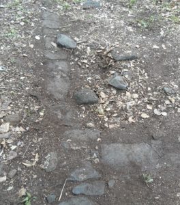
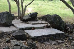
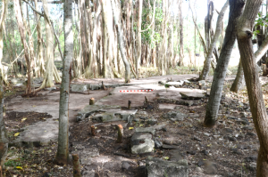
Thereafter, many residents of Trou Chenille went to settle in the areas next to where the chapel and shop had been re-located. Some of the ex-inhabitants of Trou Chenille lived in the old maize mill next to the football ground for one year until the construction of their new houses was completed. There was also a well on the site and the flooring of the old chapel is still visible. After cyclone Carol in 1960, the houses as well as the shop and the chapel were again destroyed. This time the inhabitants were moved to Le Morne Village.
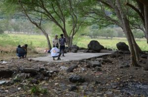
Archaeological Exploration of L’Embrasure was an intensive and exhaustive survey. The team was on the site to explore; leading to data collection and interpretation to have a better knowledge and understanding of the site and plan deeper investigation for the future.
Archaeological Research in Le Morne
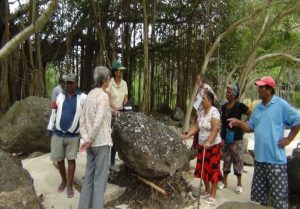
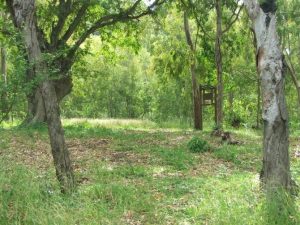
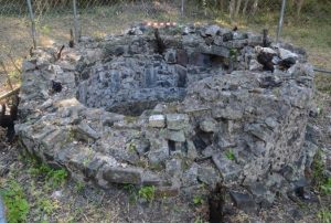
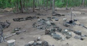
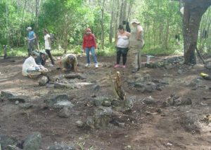
The old cemetery forms part of the rich attributes of the Le Morne Cultural Landscape World Heritage Site. The abandoned cemetery has been existed for many years on the remote area of the landscape near in the shadow of Le Morne Brabant Mountain, on a small sandy islet, which is regularly cut-off from the mainland as a consequence of tidal oscillations.
It even appears on a map of 1880. In the recent past, it was not clear who was really buried there at that time and it is currently being used as a ritual ground. It is for this purpose that excavation work was carried out in the cemetery in 2010, to know the origins of the interred.
Research and Analysis
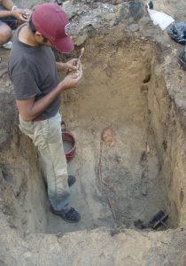
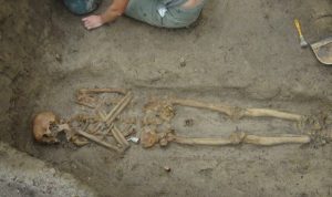
The Le Morne Heritage Trust Fund identified five structures of various dimensions which evidently delineated graves. These delineations of varying sizes were proportional to the interred, i.e. smaller graves denoting infants, larger graves for adults. A field survey was undertaken incorporating geophysics, revealed 21 structures and provided the basis for excavation in 2010, 2012 and 2013; the total number of known structures is now 45.
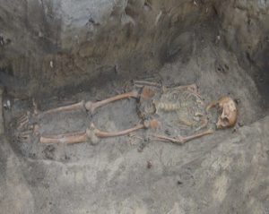
The 2010 excavation recovered six children and five adults. Osteological and isotopic analysis of the remains recovered in 2010 reveals that generally the interred were in good health, consuming a relatively good diet with relatively few indications of disease. However, the remains from later seasons ostensibly from an earlier phase of burial indicated a much higher incidence of disease, particularly inflammatory conditions.
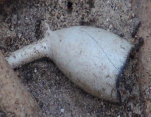
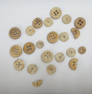
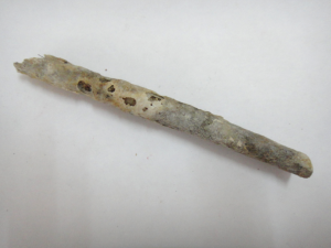
Artifacts recovered from the old cemetery also revealed nuanced details about the life-ways of the interred. Although the material culture is European in origin, it has been used in a manner reminiscent of African traditions, or, more accurately, Afro-Malagasy. Coins recovered from burial 7 suggested a period of active use around AD1835–1850.
Subsequent radiocarbon analysis gave dates that were approximately 100 years earlier than anticipated. The maternal lineage was successfully extracted from 11 individuals; of these, nine were identified as being of East African, probably Mozambican, origin, and two were Madagascan. These results lead us tentatively to conclude that the cemetery contains the remains of the very first emancipated, freeborn, Mauritians; that is, inherently free, as enshrined in law, and distinct from those granted freedom (gens de couleur libre).
According to the archaeologists the area of the cemetery could extend well beyond the initial estimate of 3600m2, and perhaps incorporate different zones of burial clustered on the sandbank. At a conservative estimate, at least 70 individuals were buried in the sector currently under investigation, and probably many more in the wider area. The area is maintained by the Le Morne Heritage Trust Fund as a place of historical interest for heritage trail and cultural tourism and an archaeological research area.
Social Historical Survey / Maroon Trails Project
In collaboration with the Centre for Research on Indenture and Slavery (CRSI) of the University of Mauritius, the following projects were undertaken:
Socio Historical Survey of Le Morne
A socio-economic survey which aims at understanding the dynamics of land ownership and dispossession, the spatial, social and economic history of the ex-slave population of the region and to formulate policy for the moral, social, cultural and economic upliftment of the population of slave ancestry and of other marginalized groups in the regions.
Maroon Trails Project
The project aims to uncover routes taken by maroons in their journeys through Mauritius and their life’s during their maroonage. This research survey will formulate recommendations for preserving existing maroon sites and identifying new sites. Archaeological research through the collection of artefacts, cave explorations, archaeological excavations and oral history research have been conducted in the South West regions of Mauritius like the cave under Chamarel waterfall, Choisy (Baie du Cap), Macondé and Dilo-Pouri area (at Le Morne).
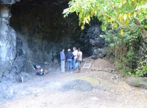
Archaeological Test Excavations in Two Rock Shelters at Macondé, Mauritius
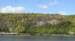
The area selected for study was at Maconde where there are several rock shelters formed by lava domes and tunnels. These shelters are to be found at the base of basalt cliffs on the southwest side of the Baie du Cap River and estuary that reach more than 60 m in height.
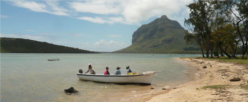
These shelters are only a few metres above the present sea-level. Since construction of the new bridge, opened in 2001, they have been protected from direct action by the river and the sea, but are still subject to flooding in cyclonic conditions. Descubes’ map of 1880 shows that there was no road past Le Grand Cap, and that travelling between Baie du Cap and Le Morne entailed a huge detour inland. The two rock shelters investigated were thus only accessible by boat or via very difficult, but not impossible, scrambles down the high cliff. It is therefore possible that they were occasionally used by maroon slaves and perhaps over a longer period by fishermen.
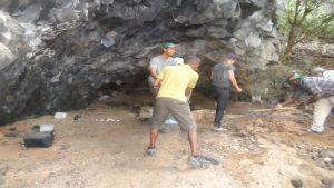
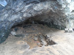
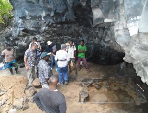
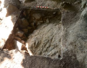
One trench was excavated in each of the two rock shelters. The one situated immediately to the south of that part of the cliff known locally as The Mushroom, because of its curved form and overhang, was labelled A, while the trench to the north was labelled B. Excavations were conducted.
Trench A
Trench A was located close to the rear of the shelter where, it was hypothesised; traces of past occupation might be found preserved at an elevation sufficiently above the high tide line. In this respect it was encouraging that there were plentiful indication for recent use that included cooking, eating and drinking, gambling, and fishing. The trench measured 1 by 1m.
A modern layer with temporary hearths indicated by patches of burning and white ash contained plastic bottle tops, fish hooks and other recent debris. This evidence proved to be only a few centimetres deep. Beneath was a layer of stony brown clay not easily differentiated from the layer of angular rocks and stones in a matrix of hard brown clay below. While some stones in the basal may have fallen from the roof of the shelter most of this layer had evidently washed in from the slopes above and to the south. This rested directly on undulating bedrock.
The only finds were a few slivers of clear glass, some poorly preserved animal bone and a few shells. Although none of the glass preserved diagnostic forms it was clear with little or no surface discolouration, suggestive of a fairly recent date.
Trench B
Trench B was situated in the larger of the two shelters that, although at a lower elevation and thus closer to the high water mark, seemed perhaps more spacious and, therefore, held more promise. Surface indications replicated those at Trench A . The trench measured 1.5 by 1m. Beneath the thin layer of small hearths and burning were two successive but clearly differentiated fills.
Excavation was abandoned before the base of the lower fill could be reached because removal of large stones would have necessitated a much larger excavation and the employment of heavy lifting tackle. It was not though that the expense and effort required would be justified by the results obtained because of proximity to the high water line. The earlier, lower layer comprised large water-worn basalt rocks in a matrix of hard, brown, gritty clay and rounded pebbles. The pebbles, some of which were more or less spherical, varied from fist-sized to only a couple of centimetres across.
There was very little coral in this layer, suggesting perhaps that the matrix was largely derived from the river. Also recovered from this layer were many marine shells; univalves including cowry, cerith and conus, and bivalves such as clams oyster, abalone and cockle. Amongst these were a few bones from large birds, most probably sea birds, including a humerus and tarsus as well as some unidentifiable pieces. Pubic and vertebral bones of sea turtles with several plastron pieces were also identified, as were fragments of Crustacea. Interestingly, indications of human activity were found in the form of a few small, >1cm, fragments of charcoal.
It also seems that many of the bigger cowry shells including the Tiger Cowry, Cypraea tigris and the Humpback Cowry Mauritia mauritiana, had been deliberately broken for extraction of the meat. The layer above comprised equally large rocks, but these were very angular not rounded by water action. Some had fallen from the shelter roof, as evidenced by molten faces. These were in a matrix of very loose sand and rounded pebbles, the latter being somewhat larger on average than those in the layer below. The assemblage of bones and shells was very similar to that in the layer below, and included the same deliberately broken shells that indicate human activity.
It is not clear what might have caused the sharp division between these two layers. The similarity in the bone and shell components of the two layers makes it unlikely that the division indicates construction of the first road in front of the shelters. Protection of the shelter from direct action by the sea by the building of the road is reflected, if at all, only by the level surface with fireplaces and evidence of leisure activities.
Concluding Remarks
In Trench A evidence for human activity earlier than the second half of the 20th century was negative. This does not mean that the shelter was not used because it is perfectly possible, and indeed highly likely, that the many intense cyclones, such as Hollanda in 1994, caused the shelter to be scoured by the sea.
Trench B, by contrast, did yield evidence for human activity in the form of small pieces of charcoal and shells that were broken by humans to extract meat, most probably for bait or consumption. No artefactual evidence that might have indicated the date of this activity was forthcoming, but the presence of bones from large sea birds together with bones and plastron fragments from turtles some of which had attained large size, suggest a time when such creatures were considerably more common than they are today.
This evidence was recovered in both of the thick layers below the modern burning, suggesting similar utilization of the shelter over a considerable period. On the other hand, there is no particular evidence to connect this human activity with maroonage. While the excavation had to be halted for reasons of safety and practicality before reaching the current elevation of the high tide, there is every reason to doubt that any prolonged occupation of the shelter, as opposed to casual use, would have been possible at a lower depth.
While these results might be considered somewhat meagre, the excavations are of significance in that a hypothesis was tested. At the same time, and importantly, the research provided an opportunity to train Mauritian students and professionals in the aims, methods and analysis of archaeological investigations and, taken together with past and future work, helps to fill out the potentially rich but scant picture of maroonage in Mauritius that is currently available.
Maritime Archaeology
The lagoon has been a witness of the past and still treasures the remnants of important part of history. An early reference to the existence of a maroon community near Le Morne during the first years of the French occupation dates back to the 8th March 1736. It relates how maroons were captured at sea in a pirogue near Cap Brabant by the crew of the ship Le Duc D’Anjou. The maroons declared that they were on their way to meet maroons already settled at Cap Brabant.
Le Morne Peninsula was surrounded by two spurs named respectively: Pointe Marron and Pointe aux Pêcheurs and one in the South-west ending with Pointe Sud Ouest. An old archival map dated 1818 from the National Archives of Mauritius indicates the Passe des Marrons (now Passe de L’Ambulante) and Pointe des Marrons – names which revealed the numerous activities of maroon slaves around this site.
Deep channels break the coral reef in two places, connecting the open sea with the lagoon system that surrounds the peninsula: these are the Passe de la Prairie and Passe de L’Ambulante both being significant as entry points through which slave vessels entered at various points. Furthermore, the lagoon has played a pivotal role in the economic history of Le Morne as according to oral testimonies of the inhabitants of Trou Chenille, ships coming from Port-Louis anchored near the area to bring provision for a shop known locally as ‘Ah-Yee’ shop. Some stuff such as wood bundles and charcoal were also shipped to Port-Louis from Trou Chenille.
The lagoon provides thus, an important ground for research. This has led to LMHTF to initiate this nascent research discipline with the help of Mr. Yann Von Arnim, marine archaeologist of the Mauritius Museums Council and Mauritius Marine Conservation Society. The aim is to shed light on this unexplored ground and to find tangible evidence to corroborate with the oral and historical written testimonies.
The research started through a survey in the lagoon of Le Morne, more precisely at some of the reef breaks and known places where shipwrecks occurred in the past. The survey at several places has led to the discovery of some wrecks suspected to originate from the Ambulante sanked in 1772, the Luzon in 1878, the Barque Maria in 1881, the Sourricade around 1878, the Chaland du Morne in 1960’s and an unknown fisherman boat around 2006.
This survey has resulted in a report entitled “Inventaire du Patrimoine Sous-marin de la Péninsule du Morne Brabant » by Mr. Von Arnim which makes recommendation for in-depth research of the underwater heritage of Le Morne through detailed study of each remains found during the preliminary survey.
Second phase: Marine Archaeology Research (2019)
The lagoon provides thus, an important ground for research. A second phrase was undertaken for in-depth research of the underwater heritage of Le Morne through detailed study of each remains found during the preliminary survey. The report is entitled Etude Archéologique des épaves de l’Ambulante (1772) et de la Maria (1881).
Yesteryear Recipes in Le Morne Village
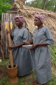
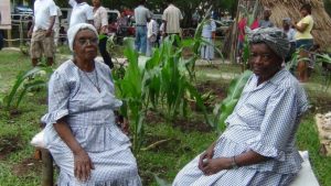
This research has been successful thanks to the active participation of the elders of the local community through knowledge sharing. Testimonies with the local inhabitants reveal that the elders prefer the food habits of old days which they consider healthier. The pleasure of planting and eating their fresh food grown in their village or gardens and the fish which they had themselves caught.
However, nowadays the elderly people have experienced a great change in their daily way of eating. In accommodating tradition and modernity, the villagers have devised a new way of eating and have strived to keep alive, as far as possible, on special occasions the essence of traditional food habits of Le Morne village. These rich culinary traditions are deeply rooted in the collective memory of the local population and especially the elders who lived in the former village of Le Morne, also known as Trou Chenille. At the time, the inhabitants who lived in Trou Chenille and in the surroundings ate a traditional dish known as ‘Diri May’.
The inhabitants had their gardens where they grew corn, cassava, potatoes, taro and other vegetables, and raised animals for their personal consumption. They fished and hunted animals such as hares, wild pigs, tenrec / tanrec and monkeys. They were living an autonomous life and adapted themselves to their environment. In addition to their culinary knowledge from their ancestors, they have incorporated the elements of the rich local biodiversity into their daily cooking to make exceptional dishes.
The Le Morne Heritage Trust Fund now has the responsibility to preserve the authenticity of that cuisine for posterity. Research and documentation is one of the measures to safeguard this intangible cultural heritage. This research consisted mainly of face to face interviews with the local inhabitant and live demonstration pertaining to their culinary skills and knowledge of traditional food which as far as possible is related to Le Morne.
The sessions were video recorded and pictures were taken for further documentation. This has resulted in a booklet launching entitled “25 Reset D’antan” translated in French “25 Recettes D’antan” and English version “Yesteryear Recipes”. LMHTF strongly believes that this book will enable the eating habits to be passed to succeeding generations, a knowledge which the elderly people of Le Morne village have been faithful in transmitting for generations.
Educational Kits
An Education Kit has been developed to provide information to teachers of primary and secondary schools in the context of their visits with students to Le Morne Cultural Landscape World Heritage Site. The kit offers essential information to document and conduct activities in class or on site.
Publications
1. Essoo, de Salle. M, Gopauloo. N, Panyandee. S, 2010. Report on Oral History and Traditions on Le Morne; Réduit, Le Morne Heritage Trust Fund.
2. Essoo, de Salle. M, Gopauloo. N, Panyandee. S, 2010. Rapport: Histoire Orale et Traditions au Morne; Réduit, Le Morne Heritage Trust Fund.
3. LOWE et al. 2010. Le Morne Cultural Landscape – History, Symbolism and Traditions. Mauritius, Le Morne Heritage Trust Fund.
4. Moutou, B. De l’esclavage au marronnage raconté à mon fils et à ma fille. Mauritius, Le Morne Heritage Trust Fund.
5. Le Morne Heritage Trust Fund, 2013. Educational Kit, Presentation of Le Morne Cultural Landscape, 1st Edition. Mauritius, Le Morne Heritage Trust Fund.
6. Le Morne Heritage Trust Fund, 2018. Educational Kit, 2nd Edition: Le Morne in the young hands. Mauritius, Le Morne Heritage Trust Fund.
7. Le Morne Heritage Trust Fund & Robben Island Museum, 2020. Comparative Experiences: The Triumph of the Human Spirits over adversity. La Tour Koeing, Government Printing Department.
8. Le Morne Heritage Trust Fund, 2018. 25 Resets Lontan. La Tour Koeing, Government Printing Department.
9. Le Morne Heritage Trust Fund, 2018. 25 Recettes D’Antan. La Tour Koeing, Government Printing Department.
10. Le Morne Heritage Trust Fund, 2019. Yesteryear Recipes. La Tour Koeing, Government Printing Department.
Booklet
11. Le Morne Heritage Trust Fund, 2014. Le Morn : Enn Sinbol, Exhibition: Le Morne: One Mountain, Many Histories. Réduit, Centre for Research on Slavery and Indenture (English, French and Creole Version).
Magazine
12. MagazineYer Rezistans zordi rezilians, 2015 (180th Anniversary of the Abolition of Slavery in Mauritius).
13. International Seminar,Yer Rezistans, Zordi Rezilians, Book of abstracts, 2015. (180th Anniversary of the Abolition of Slavery in Mauritius).
Flyer
14. Living Exhibition: Trou Sini: Memwar Nu Listwar (Trou Chenille: Our History Remembered).
15. Discovering Le Morne Cultural Landscape, UNESCO World Heritage Site (English, French and creole version)
16. Le Morne Cultural Landscape: UNESCO World Heritage Site (English, French and creole version)
17. The International Slave Route Monument within Le Morne Cultural Landscape
CD / DVD
18. Le Morne Heritage Trust Fund & Abaim, Made in O Morn (CD/DVD)

