About
Le Morne
Le Morne Cultural Landscape
Following its inscription on the United Nations Educational, Scientific and Cultural Organisation (UNESCO) World Heritage List on 10th July 2008, Le Morne is now a UNESCO World Heritage Site known as the Le Morne Cultural Landscape that belongs to humanity and symbolises resistance against slavery.
Location
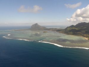
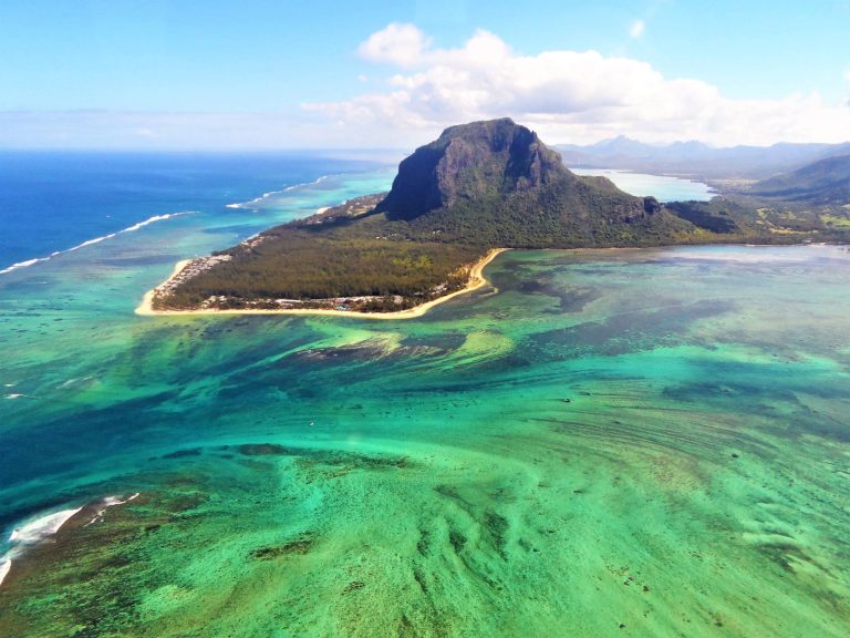
The Le Morne Cultural Landscape is located at the extreme southwestern tip of the island of Mauritius and is more commonly referred to as Le Morne peninsula and the “wild south”. For conservation purposes the landscape possesses both a Core and a Buffer zone. The Core Zone includes the entire mountain and most of its foothills while the Buffer Zone extends much further to include the entire peninsula and surrounding lagoons up to the fringing reefs. The Area is a rallying point for Mauritian from all walks of life who are deeply concerned about the country’s heritage in terms of its history, culture as well as the natural environment.
Le Morne Brabant Mountain - A Monument Of Nature
Le Morne Cultural landscape represents the combined works of nature and humans. Monolithic in appearance and surrounded by awe-inspiring cliffs, the mountain entirely dominates the low-lying landscape of Le Morne peninsula, which itself is a prime example of nature’s beauty.
The detached mountain “…rises in solitary grandeur from this little peninsula on which it stands, a spur from it forming the isthmus which unites it to the mainland.” (Clark Georges: 1859) Jutting into the Indian Ocean, the peninsula is surrounded by placid emerald lagoons lined with coral reefs with the deep blue sea in the background.
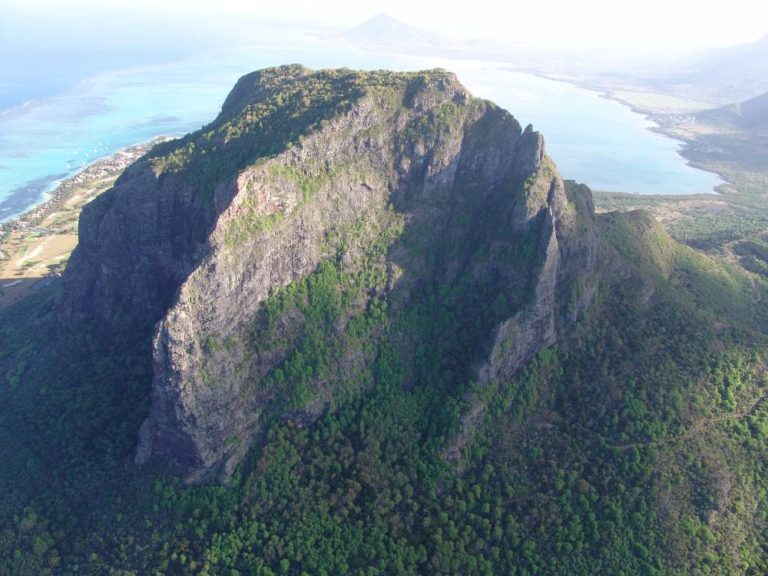
A showpiece of how Nature’s violent volcanic history shaped the island, some 8 to 10 million years ago. At the top of the cliffs and unseen from the bottom, the fertile plateau on top contributes to lush vegetation. All this breath-taking beauty provides the setting of a majestic mountain.
With its physical attributes of a natural fortress, the Le Morne Brabant Mountain and its surrounding became a cultural landscape during the 17th and 18th centuries, when groups of enslaved people escaped the control of their masters to seek refuge on the mountain. The landscape is also illustrative of the days of slavery in Mauritius and the quest for freedom that was ever present since human beings were enslaved as from the 17th, 18th and early 19th Centuries in Colonial Mauritius.
Geology
Geologically, the mountain forms part of a terminal Ankaramite olivine basalt of the oldest series, dating from eight to ten million years ago, i.e. in the Late Miocene. There are surface rocks round the edge and in some places on the plateau; there is fairly good soil layer rich in humus in some regions. There are numerous rock shelters, some of which were inhabited as illustrated by the archaeological evidence found on the mountain.
No permanent watercourses or springs are found on the top of Le Morne Mountain although according to historical records and maps, one existed at the time when maroons roamed the area. However, it is to be noted that the west side of Mauritius has become drier over the last century.
Topography Of The Mountain
The mountain easily gives the impression of a fortress. The steep slopes are intersected by ravines and valleys while the cliffs are marked by countless fissures and cracks, some of them almost as tall as the mountain itself to meet the plateau. The area at the top is well protected by steep rock cliffs that will, even today, deter any potential intruders from reaching the summit.
It is, however, not only the plateau at the top of the mountain that provided shelter for runaway slaves; the mountain in its totality is a fortress: ‘…a mother who protects and nourishes…’ The bottom of the cliffs and lower ledges are carved by numerous cracks and crevices masked by thick vegetation. Terraces obscured by the lower cliffs can only be reached by climbing up the steep lower rock faces using lianas.
All these features provide plenty of hiding places. In addition, at certain places, creeks flow and hold water for at least part of the year. In December 2006, investigators found three percolating trails of water on the south side of the mountain at the tail end of the dry season. Undoubtedly, the mountain’s complex topography offered adequate protection and means of survival to maroons.